Results

Records 1-20 of 2,740 for the search

Records per page:

Order by

Biblioteca Nacional de Portugal

1. 1ª carta dos arredores de Lisboa ao Norte do Tejo

Pedroso A. J. fl ca 1923 - 192?
Biblioteca Nacional de Portugal

2. A chart of the coasts of Spain and Portugal with the Balearie Islands and part of the coast of Barbary

Delarochete Louis Stanislas dªArcy 1731-1802 - 1779
Biblioteca Nacional de Portugal

3. A chart of the China sea

Dalrymple Alexander 1737-1808 - 1780
Biblioteca Nacional de Argentina

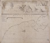
4. A draught of Cape Bona Esperança

Thornton, John, - 1743
Biblioteca Nacional de Portugal

5. A draught of the Windward cost, of the Mosquito shore from Point Pattuck to St. Iohns and continued on the Spanish Main to Escuda Veragua, with the Islands, Keys, Shoals Adjacent

Field Stephen fl. ca 1765 - 1764-1773
Biblioteca Nacional de Portugal

6. A map of New England containing the provinces of Massachusets Bay and New Hampshire, with the colonies of Conecticut and Rhode Islands, divided into Counties & Townships

Jefferys Thomas ca 1710-1771 - 1779
Biblioteca Nacional de Argentina

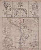
7. A map of South America containing Tierra Firma, Guayana, New Granada, Amazonia, Brasil, Peru, Paraguay, Chaco, Tucuman, Chili and Patagonia

Anville, Jean Baptiste Bourguignon d' - 1775
Biblioteca Nacional de Argentina

8. A map of South America containing Tierra Firma, Guayana, New Granada, Amazonia, Brasil, Peru, Paraguay, Chaco, Tucuman, Chili and Patagonia

Anville, Jean Baptiste Bourguignon d’' - 1787
Biblioteca Nacional de Argentina

9. A map of South America containing Tierra Firma, Guayana, New Granada, Amazonia, Brasil, Peru, Paraguay, Chaco, Tucuman, Chili and Patagonia

Anville, Jean Baptiste Bourguignon d' - 1772
Biblioteca Nacional de Portugal

10. A mar of part of Borneo and the Sooloo archipelago

Dalrymple Alexander 1737-1808 - 17??
Biblioteca Nacional de Portugal

11. A military sketch of the country between Cadiz and Marbella

Arrowsmith Aaron 1750-1823 - 1811
Biblioteca Nacional de Portugal

12. A military sketch of the country between Lisbon and Vimeiro occupied by the British Army under the command of Lieutenant General Viscounte Wellington

Faden William 1749-1836 - 1810
Biblioteca Nacional de Portugal

13. A military sketch of the country between Lisbon and Vimiero occupied by the British Army under the command of Lieutenant General Viscount Wellington

Wyld James 1790-1836 - 1827
Biblioteca Nacional de Argentina

14. A new & exact Map of the Coast Countries and Islands within ye limits of ye South sea Company, from y River Aranoca to Terra del Fuego, and from thence through ye South Sea, of ye North Part of California &c. with a view of the General and Coasting Trade winds and erticular Draughts of the most important Bays, Ports &c. According to ye Newest Observations

Moll, Herman - 1720
Biblioteca Nacional de Portugal

15. A new & exact map of the coast, countries and islands within the limits of the south sea company from the river Aranoca to Terra del Fuego

Moll Herman ca 1654-1732 - 1709
Biblioteca Nacional de Portugal

16. A new and correct map of the british Colonies in North America comprehending Eastern Canada with the province of Quebec, New Brunswick, Nova Scotia, and the Government of Newfoundland with the adjacent states of New England, Vermont, New York, Pennsylvania and New Jersey

- 1794
Biblioteca Nacional de Argentina

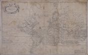
17. A New and Correct mapp of the World According to Mr. Edward Wright Commonly called Mercator's Projection with a weiw of the wind and variation

Thornton, John, - 1743
Biblioteca Nacional de Portugal

18. A new and exact map of Spain & Portugal

Jefferys Thomas ca 1710-1771 - 1717
Biblioteca Nacional de Portugal

19. A new and general map of the middle dominions belonging to the United States of America, viz. Virginia, Maryland, the Delaware counties, Pennsylvania, New Jersey & C with the addition of New York, & of the greatest part of New England & C as also of the bordering parts of the British possessions in Canada

- 1794
Biblioteca Nacional de Portugal

20. A new and general map of the southern dominions belonging to the United States of America, viz. North Carolina, South Carolina, and Georgia with the bordering Indian countries, and the Spanish possessions of Louisiana and Florida

- 1794