
|
19421. Rl. Sitio de San Ildefonso [Material cartográfico]
- entre 1740 y 1789?
|

|
19422. Roa H. 0345 [Material cartográfico]
- 1935
|

|
19423. The Road and Harbour of St. John, in the Island of Antigua. With the adjacent Coast and Shoals from Boons Point to Muskitoe Cove [Material cartográfico]
Faden, William (1749-1836)
- 1793
|

|
19424. The Road of Bastia in the Island of Corsica [Material cartográfico]
Knight, John
- entre 1793 y 1795
|

|
19425. The Road of Palleacate off the Coast of Coromandell [Material cartográfico]
Keulen, Gerard van (1678-1726)
- 1794
|

|
19426. The Roads of Greatbritain [sic] [Material cartográfico]
Faden, William (1749-1836)
- 1795
|
|
19427. Roatán barbareta (honduras). mapas topográficos. 1968
- 1968
|
|
19428. Roatán (honduras). mapas topográficos. 1968
- 1968
|

|
19429. Robbinston quadrangle, Maine (Washington county)
Geological Survey (Estados Unidos)
- 1931
|

|
19430. Roberts Mountains quadrangle, Nevada
Geological Survey (Estados Unidos)
- 1929
|

|
19431. La Robla H. 0129 [Material cartográfico]
- 1942
|

|
19432. El Roble
Instituto Geográfico Militar (Chile)
|

|
19433. Robledo H. 0815 [Material cartográfico]
Marín, R. (fl. 1885-1917)
- 1890
|
|
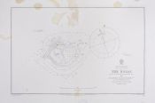
19434. The Rocas
Oliveira, A. Vital de
- 1858
|

|
19435. Rocas de Santo Domingo
Instituto Geográfico Militar (Chile)
|

|
19436. Roche Fort, ville, dont le Port et l'Arcenal, sont considerable, de la Province, de Saintonge, situeé, a lentrée, de la riviere de Charente a 45 degrez 52 m[inut]es de Latitude et 17 degrez 5 m[inut]es de Longitude
Fer Nicolas de 1646-1720
- 1723
|

|
19437. Roches de Penmarc'h 5284
Francia. Service hydrographique et océanographique de la marine
- 1908
|

|
19438. Rochester quadrangle, Michigan
Geological Survey (Estados Unidos)
- 1908
|

|
19439. Rochester quadrangle, New York (Monroe county)
Geological Survey (Estados Unidos)
- 1912
|

|
19440. Rochester Sheet, New York (Monroe Co.)
Geological Survey (Estados Unidos)
- 1898
|