Resultados

Registros 61-80 de 8.631 para la búsqueda

Registros por página:

Ordenar por:

Biblioteca Nacional de Portugal

61. A military sketch of the country between Lisbon and Vimeiro occupied by the British Army under the command of Lieutenant General Viscounte Wellington

Faden William 1749-1836 - 1810
Biblioteca Nacional de Portugal

62. A military sketch of the country between Lisbon and Vimiero occupied by the British Army under the command of Lieutenant General Viscount Wellington

Wyld James 1790-1836 - 1827
Biblioteca Nacional de España

63. A narrative of excursions, voyages, and travels, performed at different periods in America, Europe, Asia, and Africa [Texto impreso]

Rapelje, George - 1834
Biblioteca Nacional de España

64. A narrative of the voyages round the world performed by captain James Cook [Texto impreso] : with an account of his life, during the previous and intervening periods

Kippis, Andrew - 1839
Biblioteca Nacional de España

65. A natural and civil History of California [Texto impreso] : containing an accurate description of that Country : its soil, mountains, harbours, lakes, rivers, and seas : its animals, vegetables, minerals, ad famous fishery for pearls : the Customs of the Inhabitants ... together with accounts of the several voyages and attempts of that country, its gulf, and coast of the south sea : illustrated with copper plates, and a accurate map of the country and the adjacent seas

Venegas, Miguel - 1759
Biblioteca Nacional de Argentina

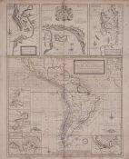
66. A new & exact Map of the Coast Countries and Islands within ye limits of ye South sea Company, from y River Aranoca to Terra del Fuego, and from thence through ye South Sea, of ye North Part of California &c. with a view of the General and Coasting Trade winds and erticular Draughts of the most important Bays, Ports &c. According to ye Newest Observations

Moll, Herman - 1720
Biblioteca Nacional de Portugal

67. A new & exact map of the coast, countries and islands within the limits of the south sea company from the river Aranoca to Terra del Fuego

Moll Herman ca 1654-1732 - 1709
Biblioteca Nacional de España

68. A new and complete System of Geography a full, accurate, authentic, and interesting Account and Description of Europe, Asia, Africa, and America ... including ... voyages and travels

Middleton, Charles Theodore - entre 1778 y 1779
Biblioteca Nacional de Portugal

69. A new and correct map of the british Colonies in North America comprehending Eastern Canada with the province of Quebec, New Brunswick, Nova Scotia, and the Government of Newfoundland with the adjacent states of New England, Vermont, New York, Pennsylvania and New Jersey

- 1794
Biblioteca Nacional de Argentina

70. A New and Correct mapp of the World According to Mr. Edward Wright Commonly called Mercator's Projection with a weiw of the wind and variation

Thornton, John, - 1743
Biblioteca Nacional de España

71. A new and easy guide to the use of the globes, and the rudiments of Geography... [Texto impreso] : Illustrated with ten plates and maps. To the whole are subjoined two appendices...

Fenning, Daniel - 1804
Biblioteca Nacional de Portugal

72. A new and exact map of Spain & Portugal

Jefferys Thomas ca 1710-1771 - 1717
Biblioteca Nacional de Portugal

73. A new and general map of the middle dominions belonging to the United States of America, viz. Virginia, Maryland, the Delaware counties, Pennsylvania, New Jersey & C with the addition of New York, & of the greatest part of New England & C as also of the bordering parts of the British possessions in Canada

- 1794
Biblioteca Nacional de Portugal

74. A new and general map of the southern dominions belonging to the United States of America, viz. North Carolina, South Carolina, and Georgia with the bordering Indian countries, and the Spanish possessions of Louisiana and Florida

- 1794
Biblioteca Nacional de España

75. A New Correct Chart of the Caribee or Windward Islands [Material cartográfico]

Moore, John Hamilton (1738-1807) - 1784
Biblioteca Nacional de España

76. A new directory for the East Indies ... : a work ... begun upon the plan of the Oriental Neptune,

Herbert, William (1718-1795) - 1780
Biblioteca Nacional de Portugal

77. A new general chart of the world

Faden William 1749-1836 - 1787
Biblioteca Nacional de Portugal

78. A new general map of the East Indies, exhibiting in the Peninsula on this side of the Ganges or Hindoostan the several partitions of the Mogul's Empire and the dominions of the English East India Company in the provinces of Bengal, Bahar, Orixa, as well as upon the coasts of Malabar and Coromandel, with the French and Dutch possessions according to the peace of 1783, and in the peninsula beyond the Ganges, the kingdoms of Assam, Cashar, Aua, Aracan, Mien, Pegu, Siam, Lao and Cambodia, &c.

Jefferys Thomas ca 1710-1771 - 1794
Biblioteca Nacional de España

79. A new geographical, historical, and commercial grammar and present state of the several kingdoms of the world : containing, I. The figures, motions, and distances of the planets, according to the Newtonian system, and the latest observations ...XII. The longitude, latitude, bearings and distances of principal places from London : to which are added, I. A geographical index, with the names of places alphabetically arranged. II. A table of the coins of all nations ... remarkable events from the creation to the present time

Guthrie, William - 1792
Biblioteca Nacional de Argentina

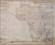
80. A new map of Africa including Arabia, the Mediterranean and part of the coast of South America compiled from the observations of the latest travellers, London, published the 1st. of Jany. 1800 by Rob. Wilkinson, Nº 58 Cornhill

Wilkinson, Robert (m. ca. 1825), cartógrafo - 1800