|
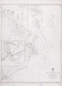
2301. Tubootch & Suco harbors [Material cartográfico]
Perry, Matthew Calbraith (1794-1858)
- 1854
|

|
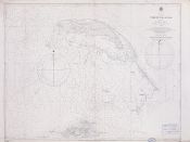
2302. Turks Islands [Material cartográfico] : From a Survey made in 1753, by the Sloops l'Aigle and l'Emeraude, by order of the French Governor of Hispaniola, with improvements from Observations, made in 1770, in the Sr. Edward Hawke Kings Schooner
Robert Laurie and James Whittle
- 1794
|

|
2303. Turtle Bay on S° Coast of Java [Material cartográfico]
Dalrymple, Alexander (1737-1808)
- 1780
|

|
2304. Turtle Bay on the Sº Coast of Java Lat. 7º 45 S. 90 leas. E. of Jave Head ; Patietan Bay on the Sº Coast of Java Lat. 8º 9 S. 120 Leas. E. of Java Head ; Flittermous on the Sº Coast of Java Lat. 8º 30 S. 178 Leas. E. of Java Head [Material cartográfico]
Dalrymple, Alexander (1737-1808)
- 1782
|

|
2305. Tyrrhenian sea : Mediterranean
Gran Bretaña. Admiralty
- 1895
|

|
2306. Underoot Island [Material cartográfico]
MacClure, John
- 1791
|

|
2307. Union Bay to Rio Negro San Blas Harbour [material cartográfico] : Rio Negro [material cartográfico]
Fitzroy, Robert (1805-1865)
- 1847
|

|
2308. Urter to Hisken including the entrace to the Hardanger Fiord and approaches to Haugesund and Lervig 881
Gran Bretaña. Admiralty
- 1895
|

|
2309. Venloos Bay in the District of Tambankarrewarre on Ceylon [Material cartográfico] : in Lat.7°55'N. 22'from Batticalo and 32'from Tricoenmale
Keulen, Johannes van (1704-1755)
- 1789
|

|
2310. Vierde Deel der Zeespiegel Inhoudende Eene beschriivinge der zeehavenen reeden en kusten van de Middellandsche Schipvaert ...
Blaeu, Willem Janszoon
- 1638
|

|
2311. View and Plan of Sinderdroo or Melundy on the Malabar Coast [Material cartográfico]
Watson, Capt. John
- entre 1765 y 1774
|

|
2312. Virgin Islands : sheet I, Anegada
Lawrance, G. B.
- 1861
|

|
2313. Virgin Islands : sheet III, Tortola to Culebra including St. Thomas Id
- 1903
|

|
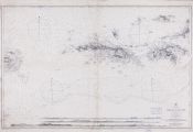
2314. The Virgin Islands from English and Danish Surveys [Material cartográfico]
Jefferys, Thomas (ca. 1710-1771)
- 1794
|

|
2315. Vues de la côte de Cochinchina N. 3548. 6ª Feuille [Material cartográfico] : du cap Sanho à Tourane
Vidalin, M.
- entre 1865 y 1877
|

|
2316. Vues de la côte de Cochinchina N. 3547. 5ª Feuille [Material cartográfico] : du cap Varela au cap Sanho
Vidalin, M.
- 1877
|

|
2317. The War in Portugall and Spain [Material cartográfico] : with the Harbours of The Groyne, Vigo & Bayonna, Porto, Lisbon & St. Ubes, Cadiz, &c. and a Chart from England to the Streights
Bowles, Thomas (fl. 1683-1721)
- 1712?
|

|
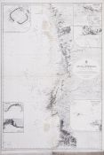
2318. West coast of Spain and Portugal : Cape Finisterre to Cape St. Vincent
- 1873
|

|
2319. The West Indian Atlas, or, a General Description of the West Indies º [Material cartográfico]
Jefferys, Thomas (ca. 1710-1771)
- 1794
|

|
2320. West Indies Island of Cuba [Material cartográfico] : Cape San Antonio to Longitude 76° West with Adjacent Part of Great Bahama Bank ; West Indies Eastern Part of Bahama Islands : With part of Cuba and North Coast of Santo Domingo : Compiled from the latest British and Spanish Charts
Mahon, Charles
- 1899
|