

Registros por página:
Ordenar por:
 |
|
 |
965
|
|
965
|


|
19281. Ravenna quadrangle, Ohio
Geological Survey (Estados Unidos)
- 1908
|

|
19282. Ravenels quadrangle, South Carolina
Geological Survey (Estados Unidos)
- 1920
|

|
Shoa (Chile)
|

|
19284. Ray and vicinity, Arizona (Pinal county)
Geological Survey (Estados Unidos)
- 1912
|

|
Chile. Armada.. Servicio Hidrográfico y Oceanográfico
|

|
19286. Ray quadrangle, Arizona
Geological Survey (Estados Unidos)
- 1910
|

|
19287. Ray quadrangule, North Dakota
Geological Survey (Estados Unidos)
- 1911
|
|
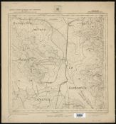
19288. Rayado Departamento de Ligua
Instituto Geográfico Militar (Chile)
- 1922.
|

|
19289. Raymond quadrangle, Illinois
Geological Survey (Estados Unidos)
- 1925
|

|
19290. Raynor Creek quadrangle, California
Geological Survey (Estados Unidos)
- 1919
|

|
Francia. Service hydrographique et océanographique de la marine
- 1904
|

|
Francia. Service hydrographique et océanographique de la marine
- 1905
|

|
19293. Real Canal de Aragón [Material cartográfico] : [desde Fontellas hasta Sastago]
Calcografía Nacional (España)
- Entre: 1970 y 1979. (Fecha del original: Entre 1700 y 1799.)
|

|
Vierge, Manuel
- entre 1860 y 1899?
|
|
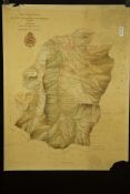
19295. Real sitio de san ildefonso (segovia). mapas topográficos
- 1930
|

|
Seutter, Matthaeus (1678-1756)
- entre 1756 y 1777?
|

|
Covens, Johannes (1697-1774)
- 1720
|
|
Instituto Geográfico Militar (Chile)
|

|
Instituto Geográfico Militar (Chile)
|

|
Instituto Geográfico Militar (Chile)
|